The installment runs into millions.
The evidence the plant was commissioned becomes an auditable report, not a PDF rebuilt from memory.
Commissioning acceptance clears the EPC installment, the claim inspection backs the insurance indemnity, and the dam safety report is signed by someone who answers for it under the law. uInspect runs every inspection of the generation asset through a single track, from request to audited report, offline at the plant and with photos geotagged at the source. It is the field evidence layer of your asset, not the monitoring system.
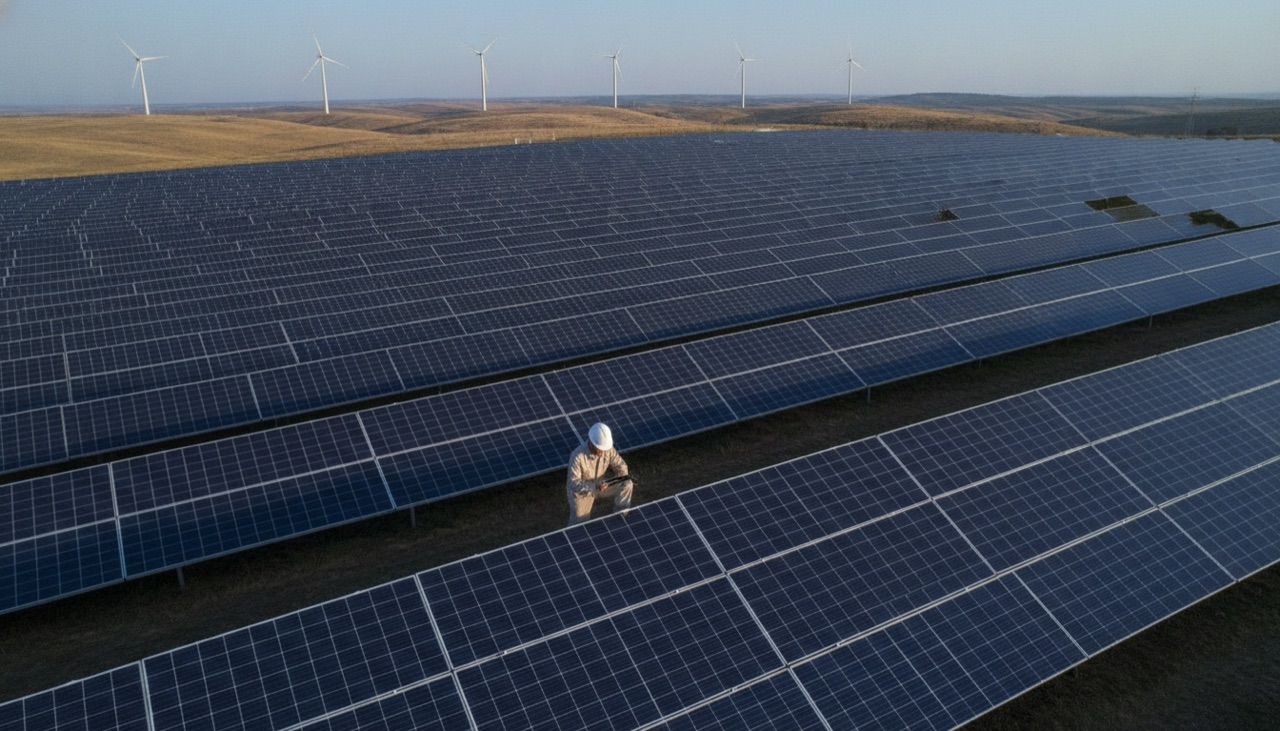
The asset is inspected string by string, container by container. And the evidence sits loose on a phone.
Commissioning thousands of strings and dozens of inverters turns into spreadsheets and loose photos on WhatsApp, and the PDF is rebuilt later, from memory.
After the hailstorm, the team runs the plant shooting photos of cracked modules on their phones, without tying the table or the date to the event, and the folder of loose images becomes grounds for cutting the indemnity.
The dam safety inspection is done with a clipboard plus a JPG in a folder, and the report is typed days later, with no coordinates on the crack and no date that can be proven.
The photo of inverter 142 does not prove it came from inverter 142, on that day, at that point.
From the plant to the report, everything runs through uInspect
The asset owner opens the request with a checklist per equipment type. The inspector walks the plant offline, at commissioning, on a claim or at the dam, and the auditable report comes out with photos geotagged at the exact point.
From request to auditable report.
- 1 The asset owner opens the request in their own workspace, with a checklist per equipment type. The owner is the tenant of the evidence, because whoever controls the evidence is whoever pays and answers.
- 2 The inspector walks the plant even without signal: an offline app that syncs by itself on reconnection, without altering the original GPS or time of capture.
- 3 Capture is born at the right point: photo, video and audio through the camera with GPS, date and time recorded on the image, including a photo of the torque wrench display, with no retyping. When media comes from the gallery, its provenance is logged with the device data.
- 4 The block enters the map in GeoJSON with area and perimeter, and the multi-page PDF report goes out signed on completion, notifying the asset owner's ERP via API.
The capabilities that turn the inspection into evidence.
The same horizontal platform, with the features this industry actually uses. Everything inside the inspection, not in spreadsheets and scattered chats.
The inspection does not stop because a plant of hundreds of hectares has no network: an offline app that syncs on reconnection, preserving the origin of the capture
The evidence is born dated and geotagged at the right point, with GPS, date and time recorded on the image, instead of a loose photo with no origin
The claim becomes a spatial dossier: a sketch of the block and the affected tables in GeoJSON, with area, perimeter and the route logged
The same engine configures commissioning, claims and dam safety: a questionnaire per equipment type, with on-the-spot validation and one report per questionnaire
The package holds up when the counterparty disputes: a signed multi-page PDF report, with a chain of custody per piece of evidence and bureau document checks on individuals and companies at the origin
Acceptance enters the release workflow instead of becoming an email with an attachment: API and webhooks open inspections and return the report, photos and answers to the owner's ERP
Concrete use cases in this industry.
Commissioning acceptance inspection of a solar plant, backing the release of the EPC installment
Weather claim inspection on photovoltaic modules for hail, windstorm and flood adjusting
Periodic visual dam safety inspection at small hydro plants, feeding the dam safety plan
Battery bank (BESS) audits for supplier acceptance and insurance renewal
Periodic nacelle inspection at wind farms as a condition of coverage and warranty evidence
Dam safety regulations and personal technical liability
Dam safety regulations require periodic inspections and a formal dam safety plan, with personal technical liability for whoever signs. When the regulator audits the plan, the evidence that the inspection happened, at that point, on that day, cannot be a signed sheet and a folder of photos with no origin. Regulators govern dam safety; they do not prescribe the format of the acceptance dossier.
The inspection that holds up, side by side with today's.
- Commissioning in spreadsheets and WhatsApp photos
- The hail dossier as a folder of loose images
- Dam inspections on a clipboard and JPGs
- Installments paid against fragile evidence
- Requests in the owner's workspace, per equipment type
- Photos with GPS, date and time tied to the point
- Blocks and tables on the map in GeoJSON, with the route
- Acceptance as a traceable event, with the evidence in hand
Evidence is born trustworthy at capture, and the buyer controls what it releases.
Every photo leaves capture with its provenance, GPS, date and time, and the inspection carries the questionnaire and the chain of custody of the media all the way to the report. With document bureau checks (individuals and companies), anti-fraud stops being a talking point: it is provenance plus a verified document. More than 100,000 inspections on record, and more than 15,000 per crop season, all to the same standard. The report stops being a loose sheet and becomes evidence that holds up when disputed, and the payer controls what it releases.
uInspect proves the procedure was executed at that point and captures the result as a photo, video or answer. It does not read instruments, do thermography, computer vision, drones or satellite, and it does not replace the BMS, SCADA or geotechnical instrumentation. It is the field evidence layer of the asset, not the monitoring system.
Questions from teams operating in renewable energy.
Does uInspect replace the plant's monitoring system?
No. It proves the procedure was executed at that point and captures the result. It does not read instruments, do thermography, drones or satellite, and it does not replace the BMS, SCADA or geotechnical instrumentation. It is the field evidence layer of the asset, alongside your monitoring system.
How does the photo prove it came from the right equipment?
Capture is born through the camera with GPS, date and time recorded on the image, at the exact point, and when media comes from the gallery its provenance is logged with the device data. That is the answer to whether the photo really came from inverter 142, on that day, and every piece of evidence carries a chain of custody through to the report.
Does it work offline at a plant of hundreds of hectares with no network?
Yes. The app works offline and syncs by itself on reconnection, without altering the original GPS or time of capture. The inspector walks the tables, the nacelle or the dam body without signal, and the inspection does not stop for lack of a connection.
Who owns the evidence, the EPC or the owner?
The owner is the tenant of the evidence, because whoever controls the evidence is whoever pays and answers. Workspaces separate projects, teams and roles with role-based access control, and acceptance sits on the side of whoever releases the installment.
How does it help in adjusting a weather claim?
The sweep delivers dated, geotagged evidence of every affected module and table, with the table polygons in GeoJSON. The dossier stops being a folder of loose images and becomes a spatial dossier that is hard to dispute, although the accepted methodology is still defined by the insurer's adjuster.
Does it work for dam safety inspection at small hydro plants?
Yes, at the visual evidence layer of the periodic inspection, with geotagged media, a chain of custody and a per-point history showing the same crack or seepage evolving between inspections. It does not replace the entire dam safety plan or continuous geotechnical instrumentation, but it makes the signature of whoever personally answers for the report defensible.
How does acceptance turn into a release?
On completion, the signed report fires a webhook and feeds the asset owner's ERP via API. Acceptance enters the milestone release workflow with the evidence in hand, instead of becoming a PDF attached to an email, and the installment moves with the evidence backing it.
How is the evidence protected against fraud?
Through provenance and bureau document checks, not image AI. Every file carries a logged origin, GPS, date and time; and bureau checks (individuals and companies) confirm who inspects and attests. The gallery is allowed, always with the file's origin logged.
The same evidence, in any inspection mode.
This industry starts with the mode that makes the most sense, but the platform is one. Explore the three modes, or see the other industry solutions.
Put evidence at the center of your renewable energy operation.
Talk to the team and see uInspect running on your use case.