The stability condition you sign
deserves a field inspection that holds up.
Pit slopes, tailings dams, waste rock piles, areas in closure. The visual inspection behind your report happens far from the office, and today it turns into loose photos and notebook entries. uInspect gives that inspection a traceable track: every anomaly positioned on the slope, with GPS and time, even without signal in the pit.
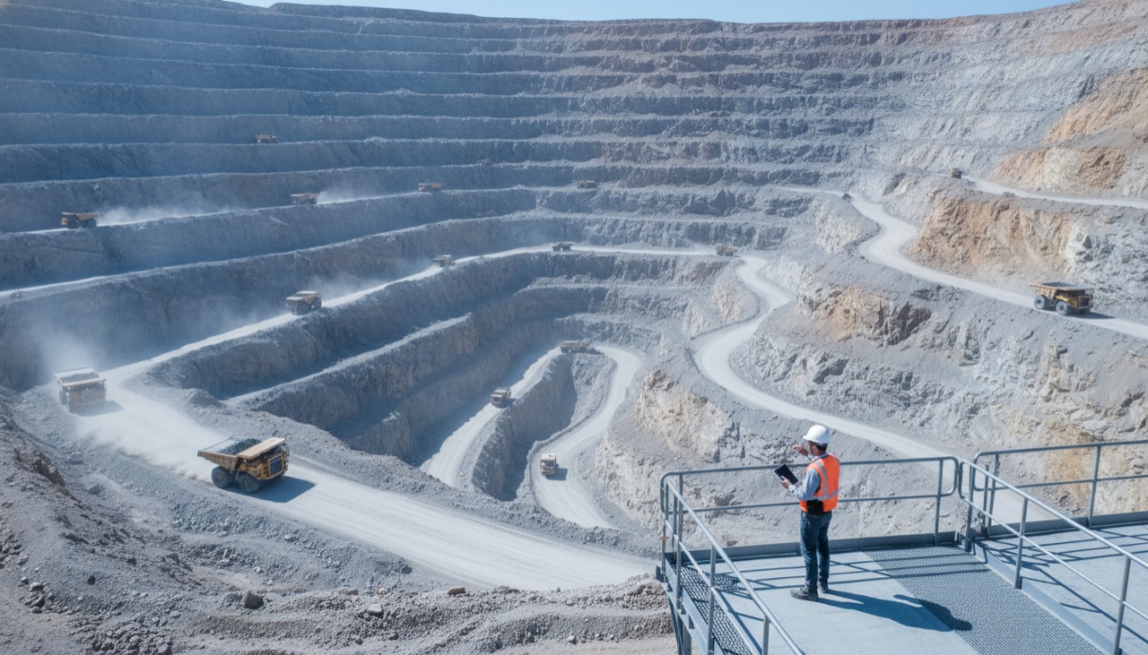
The instrumentation already has an owner. The visual inspection does not.
The technician walks the crest, the downstream slope, the berms and the spillway with a personal phone.
They note cracks, seepage, settlement or erosion in a notebook, and at night paste it all into a report.
There is no evidence the photo of the seepage was taken at that point on the berm, on that day.
When the regulator or the external audit asks for the evidence, nobody can reconstruct where each anomaly was seen or in what sequence.
From the mining face to the report, everything runs through uInspect
The inspection campaign enters the dashboard, with its frequency defined. The inspection happens at the pit and on the slope, offline, and out comes a report signed in the field with every anomaly positioned on the sketch.
From request to auditable report.
- 1 The request enters the workspace, with its frequency defined. Workspaces separate the mining company, the consultancy and the audit in the same environment.
- 2 The technician walks the pit and the slope offline: every anomaly enters as photo and video, with GPS, date and time recorded at capture.
- 3 Each point is positioned on the geotagged sketch in GeoJSON over the crest, the berms and the downstream slope, and the inspector's route is recorded.
- 4 On reconnection, everything uploads preserving the original GPS and time of capture, and out comes the PDF report signed in the field, the traceable field annex of the decision.
The capabilities that turn the inspection into evidence.
The same horizontal platform, with the features this industry actually uses. Everything inside the inspection, not in spreadsheets and scattered chats.
True offline mode in the pit and on the slope: capture runs without signal and syncs by itself on reconnection, without losing the original GPS and time
Every anomaly geotagged, with GPS, date and time at capture, placing the seepage or the crack on the sketch instead of dropping it loose in a drive
Sketches on the map per elevation in GeoJSON and KML, with area and perimeter, and an export that returns the features to your geotechnical system
The inspector's route recorded, proving which structure was walked and in what order, covering the entire campaign under audit
Instrumentation and drainage checklists with conditional logic, more than one questionnaire per inspection, one report per answered questionnaire
A report under your brand that backs the signature, with the signature collected in the field and bureau checks on the individuals and companies who inspect and attest
Concrete use cases in this industry.
Regular safety inspection of tailings dams, as the traceable field annex of the stability condition declaration
Mine closure audits and write-off of the geotechnical liability, with reshaping, revegetation and stabilization work positioned and dated
Release of working areas and pit slope inspection per shift and after each blast, with the signature of whoever authorized the face to advance
Periodic inspection of waste rock piles and the drainage network, with every erosion and silted channel placed as the baseline for the next campaign
Mine closure and dam safety regulations
At mine closure, the attestation that the actions were executed has to withstand scrutiny from the mining and environmental regulators for years. When the evidence of the reshaping is not traceable, writing off the liability and releasing the financial guarantee stay open to dispute.
The inspection that holds up, side by side with today's.
- Anomalies noted in a notebook, on a personal phone
- Seepage photos with no point and no date
- Reports pasted together from memory at night
- Evidence unrecoverable when the regulator asks
- Offline capture with GPS and time at the point
- Every anomaly positioned on the geotagged sketch
- A route that proves the campaign's coverage
- A report signed in the field, traceable for years
Evidence is born trustworthy at capture, and the buyer controls what it releases.
Every photo leaves capture with its provenance, GPS, date and time, and the inspection carries the questionnaire and the chain of custody of the media all the way to the report. With document bureau checks (individuals and companies), anti-fraud stops being a talking point: it is provenance plus a verified document. More than 100,000 inspections on record, and more than 15,000 per crop season, all to the same standard. The report stops being a loose sheet and becomes evidence that holds up when disputed, and the payer controls what it releases.
uInspect records the visual inspection; it does not prevent failure, does not declare stability and does not replace the regulator's dam management system or the geotechnical suite. The factor of safety, the water table and deformation still come from instrumentation and models. It sits alongside them, as the chain of custody of the field inspection.
Questions from teams operating in mining.
Does uInspect monitor dam stability?
No. It records the visual field inspection and gives it a chain of custody. It does not replace piezometers, radar, InSAR, geotechnical models or the regulator's dam management system, and it does not prevent failure or declare stability. What you gain is the defensibility of the field annex: the evidence behind your signature is born placed, dated and reconstructable in minutes when the audit asks.
Does capture preserve date and location even offline?
Yes. The app captures without signal in the pit and on the slope and syncs on reconnection preserving the original GPS and time of capture, not those of the sync. The origin of every file is logged, camera or gallery, with the device data, so you control provenance without relying on a promise.
How does each anomaly get positioned on the structure?
Every seepage, crack, settlement or erosion enters the geotagged sketch in GeoJSON over the crest, the berms and the downstream slope, with area and perimeter per feature. The inspector's route is recorded and proves which structure was walked and in what order, so the entire campaign is reconstructable, not a folder of loose photos.
Does it work for the stability condition declaration and the regulator's audit?
It works as the traceable field annex that backs your signature. uInspect does not issue the declaration or declare stability: it delivers the visual inspection with position, authorship and date, linked by a chain of custody through to the report, to withstand the regulator's scrutiny and the external audit for years.
How does the report hold up at mine closure, years later?
At decommissioning, the evidence of reshaping, revegetation and stabilization is born with GPS, date and time at capture, positioned on the sketch and signed in the field. Because the evidence is born defensible, writing off the liability and releasing the financial guarantee do not depend on reconstructing a photo nobody can place five years later. Local dam safety and mine closure regulations are the horizon for teams using the product here.
Can I use photos from the gallery or only the live camera?
Both. The gallery is allowed, and what matters is the logged origin: every file records whether it came from the camera or the gallery, with the device data. Anti-fraud here is provenance, GPS, date and time and the origin of the media, plus bureau document checks on the individuals and companies who inspect and attest, not AI detection on the image.
How do you separate the mining company, the consultancy and the audit in the same environment?
Through workspaces, which separate operations, teams and roles. The mining company, the consultancy hired as Engineer of Record and the independent audit coexist in the same environment, each with their own permissions, and control over who sees and attests what stays with you.
Are the proof numbers from mining?
No. The accumulated numbers are uInspect's overall history, in other industries: more than 100,000 inspections on the platform, with peaks of more than 15,000 in a single season. For dams, piles, pits and closure, any gain is an estimate until each operation measures its own. What we stand behind in this sector is the mechanism: evidence born with position, authorship and date.
The same evidence, in any inspection mode.
This industry starts with the mode that makes the most sense, but the platform is one. Explore the three modes, or see the other industry solutions.
Put evidence at the center of your mining operation.
Talk to the team and see uInspect running on your use case.