Take field evidence out of the notebook
and give the credit evidence that holds up.
In carbon, reforestation and certification, whoever pays controls the money but does not see the field: the evidence lives in a notebook, loose photos and WhatsApp. uInspect runs every field inspection through a single track, from request to audited report, with photos geotagged at the source and the polygon on the map. It is the field evidence layer of your MRV, not the MRV.
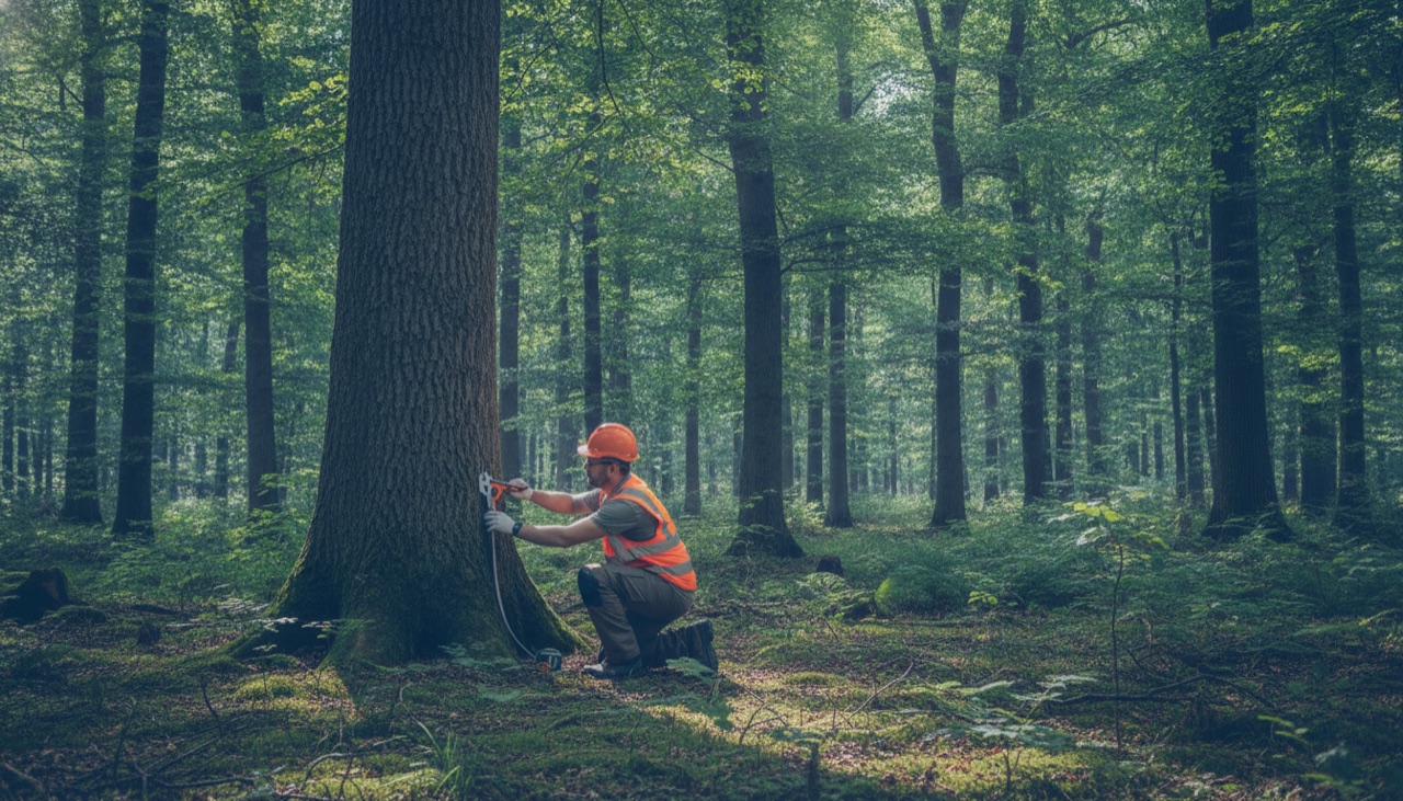
The asset is verified kilometers from the office. And the evidence is scattered.
The permanent plot measurement goes into the notebook and is retyped into a spreadsheet days later, at the hotel, opening room for transcription errors.
Photos are taken on whoever's phone is nearby, loose in the gallery, with no guarantee of which plot, which coordinates, which date.
The survival rate of a lot arrives in a PDF with generic photos that could be from another stand, another season, or repeated across lots.
The origin of a timber load and the verified management plan live in a message group, with no tie between the load, the yard, the time and the document.
From the stand to the report, everything runs through uInspect
Each plot becomes a planned inspection, and capture happens at the stand even without signal, or by the person responsible for the lot. At the end, an auditable campaign report, with photos geotagged at the right plot.
From request to auditable report.
- 1 Each plot becomes a planned inspection, registered in the workspace with destination coordinates and role-based access control.
- 2 The technician reaches the point even without signal: an offline app, with the route and distance to the plot logged, syncing without altering the original GPS or time.
- 3 Capture is born at the right plot: photos through the camera with GPS, date and time recorded on the image, and the questionnaire collects DBH, height, species and phytosanitary condition with on-the-spot validation, no retyping.
- 4 The stratum enters the map in GeoJSON and KML with area and perimeter, and the campaign report consolidates the plots and flows via API to your MRV.
The capabilities that turn the inspection into evidence.
The same horizontal platform, with the features this industry actually uses. Everything inside the inspection, not in spreadsheets and scattered chats.
Collection that does not stop where there is no signal: the offline app at the stratum syncs by itself on reconnection, without touching the original GPS or time
No more plots visited from the office: coordinates, date and time come in with the photo, on the image itself
The forest asset lives on the map, not in a spreadsheet: stratum and stand in GeoJSON and KML, area and perimeter, with offline maps
DBH, height and species enter validated at the source, not retyped at the hotel
A case file that holds up at verification: an auditable campaign report with a chain of custody per piece of evidence
Field evidence flows to the system you already use: API and webhooks deliver evidence and answers to your MRV
Concrete use cases in this industry.
Field verification of permanent plots (DBH, height, species) to back the issuance of forest carbon credits
Self-inspection of seedling survival in reforestation, through a guided link for the planting contractor, before releasing the planting milestone
FSC management field audits, with every non-conformity tied to the coordinates, date and time of the sampling point
Origin checks on timber loads at yard receiving, with the evidence tied to the lot and the cited document
Third-party verification (VVB) and carbon registries
When the third-party verifier, the registry, the accreditor or the international buyer demands the chain of evidence, a plot visited from the office contaminates the integrity of the entire credit. The evidence has to be born defensible, because there is no way to rebuild it later.
The inspection that holds up, side by side with today's.
- Measurements in a notebook, retyped at the hotel
- Loose photos that could be from another stand
- PDFs with generic survival photos
- Weak evidence that brings the asset down at verification
- Measurements structured and validated at the source
- Photos with coordinates, date and time at the right plot
- The stratum polygon in GeoJSON, area and perimeter
- A campaign report that holds up at verification
Evidence is born trustworthy at capture, and the buyer controls what it releases.
Every photo leaves capture with its provenance, GPS, date and time, and the inspection carries the questionnaire and the chain of custody of the media all the way to the report. With document bureau checks (individuals and companies), anti-fraud stops being a talking point: it is provenance plus a verified document. More than 100,000 inspections on record, and more than 15,000 per crop season, all to the same standard. The report stops being a loose sheet and becomes evidence that holds up when disputed, and the payer controls what it releases.
uInspect proves the plot, it does not calculate the credit. Biomass, inventory statistics, baseline and remote sensing stay in the client's MRV. For timber origin it proves that the check happened, where, when and with which document cited, but it does not replace the origin capture at the management stand that EUDR requires.
Questions from teams operating in forestry and carbon.
Does uInspect calculate the carbon credit?
No. It is the field evidence layer. Biomass calculation, inventory statistics, baseline modeling and remote sensing stay in your MRV system. What it delivers is the plot evidence, tied to coordinates and date, which your MRV consumes via API.
How do I prove the plot was actually visited?
The app logs the route and the distance to the plot, and the photo is born through the camera with GPS, date and time recorded on the image, at the exact plot. When media comes from the gallery, its provenance is logged with the device data. That ends the plot visited from the office and the photo that could be from another stand.
Does it work offline in the middle of the forest, with no cell signal?
Yes. The technician captures, fills the measurement and draws the sketch without a connection, at the stratum, and the app syncs by itself on reconnection, preserving the original GPS and time. Lack of signal does not break the chain of evidence.
How does uInspect help with seedling survival in reforestation?
Through self-inspection: the person responsible for each lot records the plot through a guided link, under your brand, at the real place and date, without moving your team. The survival report becomes the lot's evidence, and the milestone payment is released with the evidence in hand, not with a PDF sent by email.
Does the evidence hold up before the third-party verifier?
That is what it is born for. Every piece of evidence carries coordinates, date, time and a chain of custody through to the campaign report, and bureau document checks (individuals and companies) confirm who inspects and attests. When the VVB, the registry, the accreditor or the credit buyer disputes, the measurement is no longer word against word.
Does it work for EUDR compliance?
Not as a compliance solution. It proves that the load check happened, where, when and with which document cited, and ties the evidence to the lot, but it does not capture the origin coordinates of the management stand that EUDR requires. Use it to reinforce the documentary check, not as regulatory coverage.
The same evidence, in any inspection mode.
This industry starts with the mode that makes the most sense, but the platform is one. Explore the three modes, or see the other industry solutions.
Put evidence at the center of your forestry and carbon operation.
Talk to the team and see uInspect running on your use case.